By Sandra Cox Birchfield, Shiloh Museum of Ozark History
Take a step and be in Arkansas. Take another and now you’re in Missouri. Or just stretch out your arms and be in Arkansas, Oklahoma and Missouri at the same time – all while standing next to a slightly mysterious cornerstone!
This off-the-beaten-path attraction can be found in northwest Benton County where Arkansas Highway 43 meets the Missouri and Oklahoma state lines. Look for the blue “HISTORICAL MARKER” highway sign by the 108-year-old cornerstone. This is where travelers can stretch their legs and then have something to talk about later.
In 1932, the Springfield, Mo., newspaper ran a story about a couple marrying at the spot while standing in three states. In 1998, one of the locals told a reporter how a “fender bender” by the marker caused confusion when Arkansas, Oklahoma and Missouri troopers arrived on the scene. Local legend has it that the landmark is on the westernmost point of the Mason-Dixon Line, which can spur debates as to how far the line actually stretched.
The marker apparently has no formal title. It’s listed in Wikipedia as “OKARMO Corner” while Google Maps show it as the “AR-MO-OK Tri-State Marker.” The structure is succinct by listing each state’s name and the year it entered the union while facing its corresponding location. The fourth side notes that the Ozark Culture Club created the marker in 1915. At the top is a gray stone chiseled with the letters “MISR” and “182” with a fourth character, severely eroded, unreadable.
The story is that the rock was much larger when a local stonemason named Dave Smith chiseled it in the 1820s. He stood it up at the Arkansas-Missouri boundary, but the stone eventually fell over and was forgotten until a farmer plowed it up. The farmer created a new marker with a pile of rocks and placed the stone on top.
The Ozark Culture Club of Southwest City, Missouri, intervened in 1915 and provided a proper concrete pedestal with engravings to display the stone. In 1955, when the marker was in need of restoration, the Lions Club of Southwest City came to the rescue.
It still stands today by a bucolic highway. The only fanfare, if it could even be called that, is the rural convenience store across the road in Missouri. Its name? Corner Stone Station.
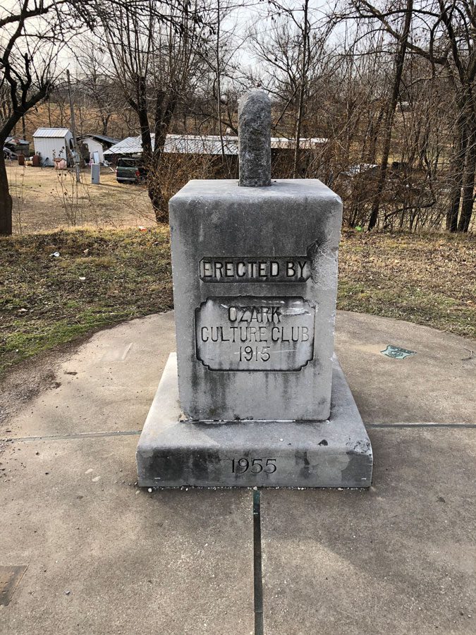
The original concrete marker was placed by the Ozark Culture Club of Southwest City, Mo., in 1915 and was restored by the Lions Club of Southwest City, Mo., which is just above the Arkansas and Missouri state line.
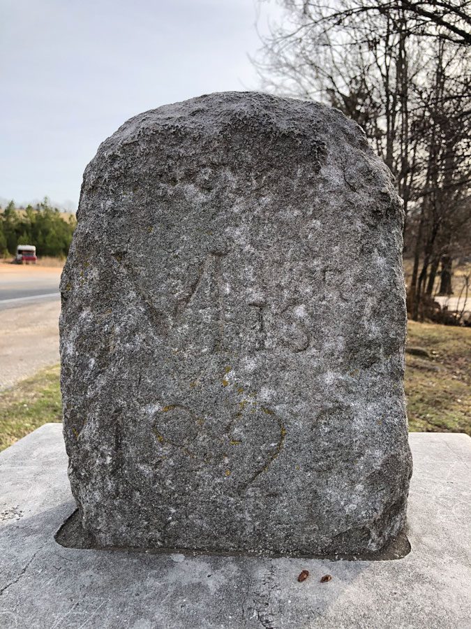
The stone atop the marker where Arkansas, Oklahoma and Missouri meet is said to have been chiseled in the 1820s by a local stonemason.
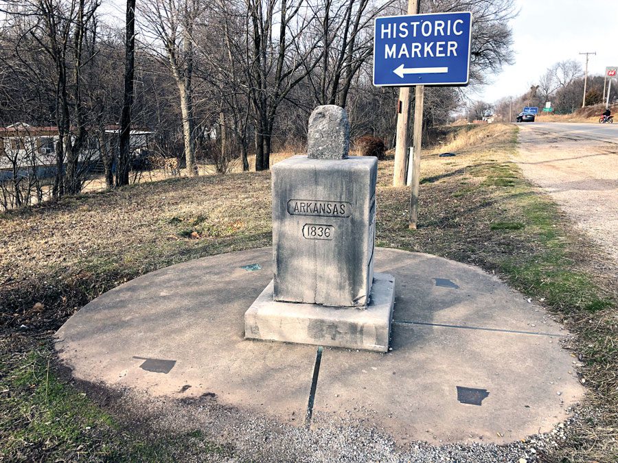
When traveling north on Arkansas Highway 43, which at times veers toward the Sooner State and becomes Oklahoma 20, be sure to look for the blue highway sign designating the marker where Arkansas, Oklahoma and Missouri meet.